A small tug maneuvers barges to be hooked up to the larger Arctic tugs.
Hay River is a very busy transportation hub to the northern communities all the way to the Arctic Ocean. On our two visits on the way to Wood Buffalo National Park and on our return visit we just got a small view into the goings-on in this vibrant community. With an extensive airport, train rail head and shipping by barge, semi’s come and going hauling fuel and goods there is always some action and we were waiting until the tugs moved. Following are my daily journal notes from day 39 of our trip a continuation of our previous blog so we could share some extra photos.
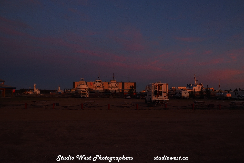
At last we see the big tugs in action.Pushing two large barges another has been taken out further into deep water to be hooked with these two which will be hooked along side the tug.Dry dock for this retired tug.Airport, rail, trucking and shipping make Hay River a real transportation hub.
Day 39…continued. Luck was on our side after 3 days in Hay River to see the barges move. The action started around eight am with a small tug taking a barge out a distance on to the lake. A much larger tug with two large barges side by side left and out in the lake the third barge was added. The smaller tug returning to port while the large one headed for the Arctic Ocean via the Mackenzie River. Northern Transportation in Hay River owns and operates the tugs as well as builds and repairs vessels and barges. Being as the large Canadian Coast Guard ship was docked in Hay River I checked to see if we could get a tour, but was told that due to Covid protocol and they were working on repairs it was not possible. Before we left one of the fellows from the smaller Coast Guard quick response vessel offered to show us aboard and explain their role in keeping our waterways unpolluted. It was great for them to take the time and we soaked up the information. This stuff is exciting for a prairie boy something I have read about but now understand better after seeing. The north is a very special part of Canada and it’s great to see and experience their isolated lifestyle and the supplying of goods and services to these communities as well as mines in the far north. We are still shipping goods on the waterways travelled by the fur traders and early explores, just in a much larger way.
Canadian Coast Guard vessels which service and patrol Great Slave Lake as well as the mighty Mackenzie River and up to the Arctic Ocean.Coast Guard ship in for repairs.Coast Guard ship in for repairs. (yellow buoys on dock)A smaller quick response vessel of the Canadian Coast Guard.On our short tour we were told the primary function is to check out damage to the environmental condition of the waterways and shorelines.Hey I could handle one of these, this baby is really equipped for a huge body of water and miles of river heading to the Arctic Ocean.In days past this was another form of transportation for the Canadian Coast Guard.Today’s snow machines are probably an up grade from these.This now sits at the Hay River Museum.
We totally underestimated Hay River as it is not one of your tourist go to places with fancy glossy brochures. We loved the lifestyle of the people here a very friendly and resilient bunch who were getting on with their lives after a major flood that spring. Hay River will definitely be a stopping place on our return to Yellowknife and the Northwest Territories.
One of the best features of the Northwest Territories is you will not find a NDP, Liberal or Conservative sign anywhere as they have NO political party’s…how refreshing.
Well our next stop will be Fort Smith and the Queen Elizabeth Territorial Campground on our way to Wood Buffalo National Park. Join us if you will, welcome to the new subscribers your interest is appreciated and now you will be notified by email when a new post goes up. I guess you all have figured it out by now we are not in Hay River, I’m writing and really enjoying the memories of our trip as we winter in our little cabin on the lake in cold old Saskatchewan Canada. Just a little behind but hey who in the prime camping and travelling season has time for computer work, I will eventually catch up. I am now computing our cost of our 10,000 plus km trip and will share that in a later post along with our over all impressions of the Yukon and Northwest Territories.
That’s it please comment if you will on any post and I would appreciate your thoughts from those of you who have travelled Alaska in a RV. Email gerry@studiowest.ca Enjoy wherever you are and may 2023 find us all healthy and ready to discover more of our beautiful countries’ nature and lifestyles hope to meet and see you down the road.
Hay River is one of those communities we felt we would blow through and just overnight. It was not a fort and no real tourist go-to-sites, it is just located on the shores of the Great Slave Lake. We stopped to see the lake and stayed 4 days, Hay River, to us, ended up being one of the most interesting places we had visited so far. No fantastic mountain views, actually it’s just kinda plain down to earth community, but one that was bustling with activities not geared to your average tourist. We loved the down to earth pace of life, the fishing boats would leave and return with their catches daily. Large tugs maneuvered huge barges being loaded with fuel and goods. A train destination for goods to the north including fuel which was trucked daily in convoys from Hay River. The Canadian Coast Guard ships tied up at dock which come and go to the Artic Ocean via the massive Mackenzie River. Lots to see, glad we took the time to stop and look and someday will return. They have a great campground right on the shores of the Lake. Enjoy the photographs our daily journal follows.
Day 36 Mileage 7,110.2 kms, travelled 381.8 km today. Left our friends’ place this morning and toured the Rock and a specialty shop in Yellowknife. Filled with propane and fueled up at Co-op, dumped tanks and filled with water in Yellowknife. Drove to Lady Evelyn Falls Territorial Park km 167.1 (mile103.8). It’s located approx. 8 kms south off highway one and the park features 23 powered campsites, laundry room, showers and the main feature the dramatic Lady Evelyn Falls on the Kakisa River. A very well kept campground with nice sites.
The incredible Lady Evelyn Falls NWT.Camped with the falls out our backdoor, the site even featured a deck. The 29 sites all had power a very well kept laundry room, showers and washrooms.The falls form a giant curtain as the Kakisa River overflows a limestone escarpment.A trail and a very steep staircase leads to the base of the falls.The Kakisa River is a warm boulder strewn river with many areas for swimming and fishing which we were told was excellent.Lady Evelyn Falls is located seven kms south of the McKenzie Highway. An excellent campground but like most no cell service.
Day 37 Mileage 7,260.1 travelled 149.8 kms today from Lady Evelyn Falls to Hay River. On the way we stopped at McNallie Creek Falls just off the highway to Enterprise where we topped up with fuel at $2.10/litre. Arriving at Hay River we checked in to the Territorial Park and spent the day exploring the large barges and the huge tugs that push or pull them. These large tugs are propelled by four V16 Caterpillar diesel engines and have a range of 8,000 kms.
This overnight stop turned into a four day stay over and another two nights on our return trip. a great park with very clean facilities and a great camp host.Some retired Arctic tugs earned a peaceful retirement with a view of Great Slave Lake.Work horses now retired sit idle on the shoreline.Large barges loaded awaiting delivery up the McKenzie River to communities along the way the way to the Arctic Ocean.
Great Slave Lake is huge. It’s the ninth largest in the world and second largest in the NWT, second only to the Great Bear Lake. The lake is also one of the deepest at 614 meters and covers a surface area of 28,568 square kms. Hay River is a transportation hub to the north by barge all the way to Tuck on the Arctic Ocean. The barges are huge and much needed supplies to communities and businesses in the north. Commercial fishing is another main part of the Hay River economy that started in 1945 with approximately 6 million lbs harvested annually, however now that figure is approximately one million lbs.
This should be the case everywhere, as the beaches were very clean.Great Slave Lake one of the largest in the NWT behind Little Bear Lake.Fisherman’s Wharf where every Saturday the local fishermen bring their catch for sale.Commercial fishing is one of the industries in Hay River.
After getting settled we spent the day just sitting on the beach looking at a lake with no shore in sight and listening to the waves, were told the Aurora Borealis is possible to be seen, a little early but if we can stay awake long enough would be a great sight to see.
After a major flood in the spring a lot of dead fall was left on the beach washed up and bulldozed into piles. Used by many for firewood on the beach firepits.
Day 38 Mileage 7279.9 kms Travelled only 20 kms today to pick up a few supplies and check out Hay River downtown. We spent the rest of the day organizing the camper and just taking the odd hike down the long beach and just sitting a spell. We moved out of the regular in the bush campground to the group camping site today. The group camping is right on the beach and out in the open so we can see all the action on the river and lake. Hopefully out here if there are northern lights we will have a better chance of seeing them. No mosquitoes in the group site as it is more breezy and only 5 other units, still cost the same as regular campground with power $29.00.
The view from our campground on the beach.We loved the campground so much we pretty much felt like staying even longer but the road was calling.
Day 39 No Mileage today as we did not drive except to the Hay River museum. The museum was flooded this spring when Hay River flooded and was closed but they set up a smaller version which we toured then did a short drive to a different beach. Spent the rest of the day in maintenance, Char did laundry and we visited with other campers and just relaxed here for another day. The barge movers did not move again today so we just may be out of luck to see one in action. At about 1:30 am our camper lit up like day and the campsite area around us. Getting up to check out the sudden daylight we discovered an Arctic Tug had come in and are they lit up front and sides on all three levels. It finally docked and the lights dimmed and its generators hummed the rest of the night. That did not bother us as much as the couples who parked to watch submarine races and needed the music thumping for all to hear. OK I was up anyway so I checked out the Northern Lights and there was definitely some colour happening so I dragged out the tripod and got a few shots.
An Arctic tug awaiting barges being loaded caught the evening light just right for this image.Tugs lit up by the moon at three in the morning, days are long here and short nights.The skies at night were just beautiful a little early in the season for the full northern light experience.It was hard to leave beach front property with views like this.I’m up at three in the morning might as well take a couple more images of the beauty hard to capture the complete beauty in an image.Now you can all see why we stayed more than one night, if they would have had a monthly rate we would have taken it in a heartbeat. A great spot to spend our time in Hay River.
That’s about it for this post, because I have many images I wanted to share and our return trip to Hay River. I have decided not to push my luck with your attention span and break this into two parts. Those huge Arctic tugs did move and I got it all recorded along with more images of Hay River, the Canadian Coast Guard and more to come in my next post. Join us then, subscriptions to the post are free and ad free a subscription will allow me to notify you of a new post by email. Thanks to all those who have already subscribed makes it easier for me as I am no longer posting to Facebook…just Instagram at gerrypopplewell.
Thanks again for joining us for a look at our beautiful country your comments are always welcome and we hope to see you down the road….
Yellowknife: (/ˈjɛloʊnaɪf/; Dogrib: Sǫǫ̀mbak’è]) is the capital, largest community, and only city in the Northwest Territories Canada. It is on the northern shore of Great Slave Lake, about 400 kms (250 mi) south of the Arctic Circle, on the west side of Yellowknife Bay near the outlet of the Yellowknife River.
Old Town Yellowknife located on a bay of the Great Slave Lake.
Yellowknife is on the Canadian Shield, which was scoured down to rock during the last ice age. We found the surrounding landscape very rocky and slightly rolling, very similar to our trip into northern Manitoba in the Flin Flon area also one of our favourite trips. There are many small lakes in addition to the larger Great Slave Lake the second largest lake in the NWT of Canada. It is also the deepest lake in North America at 2,014 feet and the 10th largest lake in the world by area. Trees such as spruce and birch are abundant in the area, with smaller bushes, but there are also many areas of relatively bare rock with lichen. Due to Yellowknife’s high latitude daylight hours range from five hours of daylight in December to 20 hours in July. Twilight lasts all night from late June to mid-July. This took some getting used to as RVers we head to bed when it gets dark, making for some long days.
The Canadian Shield rock, water and short trees.A great place to start a wilderness canoe trip from.Barges are part of the transportation hub in Yellowknife.
While we were there it was a little overcast with light rain and we’re told by our friends in August this was normal. Yellowknife has a subarctic climate with winter being predominantly polar, rapid heat waves emerge at the summit of summer due to the immense path south. Yellowknife experiences very cold winters and mild to warm summers. The average temperature in January is around −26 °C (−15 °F) and 17 °C (63 °F) in July. According to Environment and Climate Change Canada, Yellowknife has the sunniest summer in the country, averaging 1,034 hours from June to August. The lowest temperature ever recorded in Yellowknife was −51.2 °C (−60.2 °F) on 31 January 1947, and the highest was 32.6 °C (90.7 °F) on 2 August 2021. In 2014, Environment Canada ranked Yellowknife as having the coldest winter and longest snow cover season of any city in Canada, while also experiencing the sunniest spring and summer of any city in Canada.
Yellowknife, like most other urban centres, has distinct commercial, industrial, and residential areas. Frame Lake, Niven Lake, Range Lake, and Old Town are the residential sectors, with some of the population living in high-rises in the downtown core. Another area that amazed me was the houseboat community. Jolliffe Island sits in Yellowknife Bay and is public land under the jurisdiction of the City of Yellowknife after a land purchase when Imperial Oil vacated the site. The island is surrounded by a community of houseboats, where people have been living off the grid since 1978. Their relationship with the city is complex and often strained as the houseboats are popular with sightseers, but at the same time their residents live outside of the city’s tax jurisdiction while still using city services. I would really love to tour one of the houseboat homes to see their set up off grid. Some people like a big house on the rocks some like a little house on the rocks and some like a little house on a barge should be room for all. I could live in a RV no problem but many could not.
A community of floating homes one would expect to see on the West coast.They call it being at home on the water.
It’s amazing to see how many of the original business and their location still exist in Old Town yet today pointed out by Wayne on our crash tour. So it motivated me to dig a little deeper into the history which I will share hopefully in brief.
One of the first hotels still serving customers in Old Town.The Wildcat Cafe good eating still today and an original business in Old Town.A short unpaved road in Old Town area of Yellowknife started as a joke by area landowner. Ended up being a song by Tom Cochrane and a tourist destination.
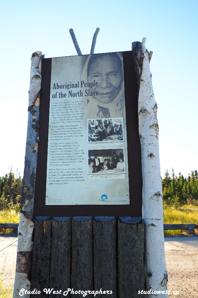
Yellowknife and its’ surrounding water bodies were named after a local Dene tribe, who were known as the “Copper Indians” or “Yellowknife Indians”, today incorporated as the Yellowknifes Dene First Nations. They traded tools made from copper deposits near the Arctic Coast. Its population, which is ethnically mixed, was 19,569 per the 2016 Canadian Census. Of the eleven official languages of the Northwest Territories, five are spoken in significant numbers in Yellowknife Dene, Dogrib, North and South Slavey, English, and French. In the Dogrib language, the city is known as Sǫǫ̀mbak’è (Athabaskan pronunciation: [sõːᵐbakʼe], “where the money is”). Modern Yellowknifes members can be found in the adjoining, primarily Indigenous communities of Ndilo and Dettah.
Burial in the NWT sometimes reflects on the different cultures and traditions.One of many unique gravesites.
The Yellowknife settlement is considered to have been founded in 1934,after gold was found in the area, although commercial activity in the present-day waterfront area did not begin until 1936. Yellowknife quickly became the center of economic activity in the NWT, and was named the capital of the Northwest Territories in 1967. When the gold activity died down Yellowknife was primarily a government town during the 1980’s. The discovery of diamonds north of the city in 1991 changed all that with transportation, communications and tourism adding to the industries today.
Con Mine was the most impressive gold deposit and its development created the excitement that led to the first settlement of Yellowknife in 1936–1937. Some of the first businesses were Corona Inn, Weaver & Devore Trading, Yellowknife Supplies and post office, and The Wildcat Cafe. Con Mine entered production on 5 September 1938. Yellowknife boomed in the summer of 1938 and many new businesses were established, including the Canadian Bank of Commerce, Hudson Bay Company, Vic Ingraham’s first hotel, Sutherland’s Drug store, and a pool hall.
The famous Giant Mine.An original Con Mine cabin.
The population of Yellowknife quickly grew to 1,000 by 1940, and by 1942, five gold mines were in production in the Yellowknife region. However, by 1944, gold production had ground to a halt as men were needed for the war effort. An exploration program at the Giant Mine property on the north end of town had suggested a sizable gold deposit in 1944. This new find resulted in a massive post-war staking rush to Yellowknife.It also resulted in new discoveries at the Con Mine, greatly extending the life of the mine. The Yellowknife town site expanded from the Old Town waterfront, and the new town site was established during 1945–1946. The Discovery Mine, with its own town site, operated 81 km (50 mi) to the north-northeast of Yellowknife from 1950 to 1969.
Ice trains of the northServed its time on the Ice Trains.Ice train cabin.The Alligator history.One of the few remaining perhaps only “Alligator”.Reminders of a different time.Power by steam boiler, considered environmentally friendly back then.
A new mining rush and fourth building boom for Yellowknife began with the discovery of diamonds 300 km (190 mi) north of the city in 1991. The Giant Mine was the subject of a bombing during a labour dispute in 1992 that resulted in one of the deadliest mass murders in Canada with 9 deaths. The last of the gold mines in Yellowknife closed in 2004. Today, Yellowknife is primarily a government town and a service centre for the diamond mines. Today the Giant Mine is back in the news as the most expensive mining cleanups in Canadian history. With an estimated cost of around four billion and ongoing costs for safe storage of the arsenic recovered from the contaminated site, it should serve as a reminder to us how important environmental protections in future operations are. In Canada there are more than 20,000 locations on the federal contaminated sites inventory. We viewed only part of the massive clean-up and believe me it is massive.
Today, Yellowknife is primarily a government town and a service centre for the diamond mines. On 1 April 1999, its purview as capital of the NWT was reduced when the territory of Nanavut was split from the NWT. As a result, jurisdiction for that region of Canada was transferred to the new capital city of Iqaluit. Consequently, Yellowknife lost its standing as the Canadian capital city with the smallest population.
There is so much more to Yellowknife I have just scratched the surface. We loved the area round the city the vast wilderness lakes and rock mixed in with the tree growth. If you love nature, hunting, fishing and camping in a wilderness setting this trip may be for you. Thanks to Wayne,Annelle and girls for your hospitality and friendship. Enjoy the images a few of many.
We are off to Wood Buffalo National Park Canada’s largest National Park and one of the largest in the world established in 1922 to protect the last remaining herds of bison in Northern Canada. What was going to be a quick overnight in Hay River on the way ended in a not planned extended stay. Tell you why in the next Post…
Leaving Yellowknife for Hay River way down the road.
Take care out there and we really hope to meet you down the road…may the wind be in your back.
Yellowknife, the city at the end of the road in the Northwest Territories. I have many images to share of this unique community so will break it up into two parts. These are notes from my daily journal which I am so thankful I kept regularly, or I would be lost. We really enjoyed our time with our new friends and the time was a personal refresher for us, so the report is brief, so I hope you enjoy the images. Part two will feature a little more of what we discovered in and about Yellowknife.
Old town Yellowknife on Great Slave Lake.
Day 34 mileage drove today from Reid campsite to Yellowknife, called some friends that we met in Hythe, and are staying in their driveway tonight. They treated us to a nice meal and a tour of Yellowknife, also met their friend John. A lot of history around the diamond mines here and the number of people just squatting and not paying taxes living either in house boats or on lease land is surprising.
For some, home is on the water spring, summer, fall and winter.
Day 35 did not drive at all today, met with Wayne, Annelle and family and John this morning for a nice visit, they are all residents of Yellowknife. Had lunch and Wayne took Charlotte and I by boat up the Yellowknife River to the Tartan Falls by Prosper Lake, did some fishing catch and release. Enjoyed the hospitality and friendship of our new friends for the evening and stayed again in their beautiful back yard. Tomorrow we will explore a little more of Yellowknife before heading down the road, good people will be sad to leave, had a great time.
Up the Yellowknife River with our friend Wayne as guide.Best part for us no paddling Wayne was doing all the work and we enjoyed the scenery.They call it Tartan Falls but at this time of year it’s more like rapids.Falls or rapids it was beautiful and calming.Charlotte and Wayne did not catch anything at the falls.I can not even come up with a decent story on this catch. Think I may have played it too long.Poor fishing here today but the view was worth it.This fellow was waiting for leftovers.The river is claiming this abandoned boat.The Rock, a historical feature in Yellowknife. The stairway to the top of the Rock in Old Town Yellowknife.Great Slave Lake and the harbour from the Rock.A must see when visiting Yellowknife, the view is amazing.Floating fish processing plant.Fishing a big part of the northern economy.Transport barges all sizes.They call it being at home on the water in winter, they freeze in and become a remote offshore community.Now anyone that knows me will understand this was my favorite, it was not for sale.A view of the city of Yellowknife or new town from The Rock.Aircraft and float planes are a big part of the transportation of goods and people in the north.When building in the Canadian Shield one builds where you can find a flat area on the rocks and access to it.Built on a rock.Looking out over to the Great Slave Lake from The Rock.Coming back down was a lot easier but well worth the effort.
Thanks for following along and welcome to our new subscribers, your interest is appreciated, and I feel my time is well spent our site is now over 15,000 views. Our next post will feature more about what we discovered in Yellowknife and images to go with it. The community has so much history we could not absorb it all in one visit and we short-changed ourselves this time so that leaves the door open to a return visit. Visit our blog again for part two on Yellowknife and more images.
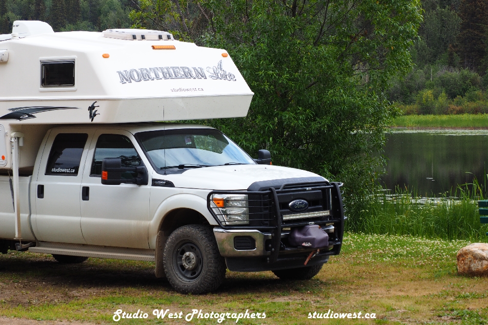
I had a very interesting call from one of our subscribers, Wayne a fellow RV traveller from Saskatchewan, regarding truck campers and our travels. We love our truck camper and over the years have not found a better way for us to travel and leave a small footprint which readers of this blog can attest to. Wayne shared his impression of their recent travels into Alaska and the Yukon and tells me they enjoyed the Yukon campgrounds and scenery the most and are looking forward to returning to the Yukon and up to Tuk. We have kinda planned on the Alaska trip this summer so would really like your feedback from those of you who have travelled to Alaska in the past several years regarding costs, campgrounds, roads and perhaps favourite areas to see in general. We are torn between more time in the Yukon and or Alaska so any help would be appreciated. The best opinions are from those who have been there and done that. Drop us a note at gerry@studiowest.ca is probably the best way also text may work 306 229-4542
That’s it for this go round hope to hear from you or see you down the road.
These locals have the right of way and can be found just about anywhere along the roads.As we learned the proper name is Bison not Buffalo.
Day 31 Mileage 6,557.6 kms. We travelled 340.5 kms today from Fort Providence to Yellowknife. After touring Fort Providence we headed out across 200 kms of burnt out forest, and forest in an ever-changing variety of trees. We ran into several wood bison herds on the way and all had young by their sides. We also spotted a black bear just outside the Fort. We took our time travelling, checking out spots we could boondock on our way back. About 100 kms from Yellowknife the landscape changed drastically from sandy forest land to rock and the closer to Yellowknife the larger the rock size and amount of rock. Yes we are in the Precambrian Shield of Canada where they build cities on a rock. We got in later and the truck and camper were totally covered in mud from gravel roads and construction so after several frustrating attempts we finally found a carwash, $22 later it was near clean. We then fueled up $1.79/litre and checked in at the Fred Henne Territorial Park at $33.50. The park has showers, swimming area, and boat launch and washroom facilities. Being as it is on the outskirts of Yellowknife the nearby airport and highway make it a bit noisy. We had requested a non-electrical site and were told they were all electrical. Later finding out there must have been a communication breakdown as we found a number of un-serviced sites. See what tomorrow brings.
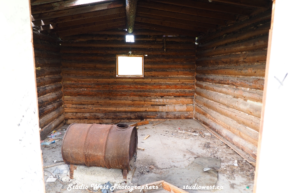
Closer to Yellowknife the landscape changed as we entered the Canadian Shield.Built on the rocksWelcome sign to Behchoko native community along the road to Yellowknife.No french here.Our first view of the Great Slave Lake from the northwest end.Great Slave Lake, one of the largest inland lakes in the world.Home of the Thcho people North Arm Territorial Park.A proud heritage lives on in the north.Our stay at the Fred Henne Territorial Park on the outskirts of Yellowknife.A very unique campground built amongst the rock.Great hiking and a large beach area are features of the park as well as the close proximity to Yellowknife.The park has many areas of interest regarding the native settlers and people of the area. Not gold but diamonds, and the early mines lots to discover.An original log cabin in its natural setting Still weathering the storms and hand built.The windows appeared to be low to me.Beauty is everywhere if one looks.
Day 32 Mileage 6,656 kms travelled only 98.3 kms today from Yellowknife to the end of the road then back to Reid Territorial Park campground. We picked up some supplies at Co-op in Yellowknife and found grocery prices quite comparable with those in Saskatoon some items a little more some a little less but pretty much on par. We then headed to the end of the road down Highway 4. The end of the road is at Tibbet Lake where in the winter the ice road starts so semis can haul supplies to the diamond mines further north. A beautiful drive and a really nice stopover area at the roads end. The water is clear and the air totally unpolluted fresh. The drive takes you up and down a curvy road through rough rock landscape of the Canadian Shield. On the way back we stopped at Reid Lake campground. The campground offers dry camping only but has showers, potable water and sani dump. This is possibly one of the nicest campgrounds we have stayed at on our trip and there have been some really nice ones. The tent camping facilities up in the rocks are fantastic and the RV sites are large, well maintained and not a bad one on the loops. Our mid-week rate was $11.81 and the weekend rate (Fri. to Mon. $23.63 taxes in). Firewood not included but available at $10/bundle. Reid Lake is great for canoeing, fishing and the start of a canoe route that finishes in Yellowknife. We were not planning on staying but booked 2 nights which was all that was available to us. Unfortunately, as with all parks that offer online booking reservations weekends and prime time the sites are all booked but not always utilized. We loved the Yukon no reservation first come first served policy worked in the past for campgrounds and works just fine now for the Yukon Parks and tourists.
On our way to the end of the road. Starts out paved twisty and a lot of hills and valleys.It always starts out paved then the pavement ends.The sign was down but we found the end of the road it stops at water’s edge and that’s as far as you get until freeze up.Well worth the drive and a beautiful quiet stop with no more road to travel.Always time for a break from driving.Our lunch stop at the end of the road.A great view from the end of the road just natural wilderness.The Canadian Sheild is definitely unique and a must see to realize the gigantic size some rocks can be.
Day 33 No mileage today as we did not move we enjoyed Reid Lake campground it was quiet this morning a slow start. We talked ourselves into inflating the Sea Eagle and going for a paddle to see the rapids and totally enjoyed a morning on the water. We managed to dock on the rocks and hike overland to see the rapids and the effort was worth it. A day of hiking, showers, camper maintenance, I also managed to get some writing done on my blog as we will be leaving for Yellowknife tomorrow and cell coverage. I took time out of my writing when a fellow I had been talking to from Ontario asked me to fillet and debone a couple of Jack he had caught with his grandson. So after a two fish deboning class I decided never to tell anyone I knew how to debone Jack again. An evening of sitting around the fire and a short hike, it’s getting busy and nosier now as the weekend locals are arriving. We’ll be on the move again tomorrow it was nice and a great campsite. We had threatened some friends we met while in Hythe on our way to Dawson City we would visit them in Yellowknife sometime. Well as we were departing their daughter said ‘see you in Yellowknife’ at the time considered a bit of a joke between us as we were not planning to head to Yellowknife on this trip. Well as you know our plans changed, we enjoyed their company in Hythe and tomorrow we would end up on their driveway, we did phone to warn them, and lesson learned be careful who you invite they may show up.
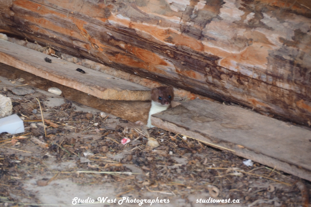
The road leading up to Reid Lake Territorial Park home for the next two nights.Reid Lake home for two nights would have stayed longer but online reservations trumped being there in person, so we had to leave.Lakes everywhere this the view from Reid LakeReid Lake.Just about as dark as it gets up here at Reid Lake.It’s no wonder this campground is popular with tent sites like this and not a bad RV site in the whole campground.Caught this fellow on a hike not sure what it is looked like it could be a Black Fox if there is such a thing.We finally inflated the Sea Eagle and went to check out the falls we were told about by the other campers.A very beautiful rocky shoreline.We hiked across to the falls having stopped on shore up stream.The falls were more like rapids but still not into trying to navigate them.Trees water and rocks it just does not get better for me.The camera or perhaps the photographer cannot do justice to the beauty one sees.Just could not help photographing the contrast.Now this is tenting near Reid Lake.
Thanks again for following along and hope you enjoy the photographs we really enjoyed the Northwest Territories and the vast wilderness. In my next blog we will share some experiences and photographs of a very unique northern city Yellowknife NWT.
We are now back home at the cabin in Saskatchewan and slowly catching up on sharing our travels to the Yukon and NWT returning through northern Alberta and Saskatchewan and you’r invited along….hope to see you down the road!
Day 28 Mileage 8596.4 travelled 232.9 kms today from gravel pit near Fort Nelson entering the Northwest Territories to Fort Liard free recreation campground. There is a fire ban in effect here so no fires tonight even though they have free firewood. Nice recreation site with 12 free campsites, so far only two RVs here, pit toilets, fire rings and tables alongside Hay Lake just outside of Liard. We filled up in Fort Liard today for $1.90/litre so one of the cheapest so far. Our NWT experience is just beginning to unfold, drove through construction on the gravel section after crossing into the NWT. The drive from Fort Nelson has been beautiful spotting lots of buffalo along the way. Highway to the NWT is fantastic, BC really does have good highways. Very relaxing drive after the Alaska Highway, met probably four other vehicles in the 200 kms and were passed by two gravel trucks. At Hay Lake there is a lot of ground clover and I have never seen so many bumble bees, the ground is alive with them…perhaps no crop spraying here.
Fort Liard is at the junction of the Liard and Petitot rivers and has a population of around 600. The area’s relatively warm climate earned it the nickname of “Tropics of the Territories”. The South Slavey Dene have resided here for many generations hosting traditional gatherings and passing down oral history. They traded with Euro-Canadians in the 18th century and later the Hudson’s Bay Company.
A long road ahead as we leave BC, Fort Nelson on our way to Yellowknife, NWT.Paved from Fort Nelson to Fort Liard on the BC side. Highway 7 was very rolling to say the least, but excellent condition.A lunch break and stretch in one of the many gravel pits just off the highway.We found gravel pits not used as an excellent place to over night or simply take a break from driving.Our campground outside of Fort Liard right on the lake.Hay Lake viewed from the back door of our truck camper at Fort Liard.We really appreciate the effort local residents put into these campgrounds that are provided free of charge.
Day 29 Mileage 5,889.5 kms today we traveled 293.1 kms. We drove from Fort Liard on Highway 7 or the Liard Trail to the Junction of Highway 1 which was all gravel. We then took Highway 1, a paved highway to the ferry on the Liard River and crossed to Fort Simpson. It rained all night in Fort Liard and throughout the morning and the mosquitoes were terrible. We drove close to 90 kms on muddy roads then into sunshine for the rest of the day, temp around 20C. We will spend the night at Fort Simpson Territorial Campground. Very nicely kept with pit toilets and showers that were closed, there are only a few of us here tonight. Fort Simpson is known as the “Gateway to the Nahanni” since it is used for a lot of people as a starting point for trips to the mountains by boat or by plane. Fort Simpson is known by the Dene as Lidlii Kue (“place where they come together”). Fort Simpson has a population of 1202 residents a community first formed as Fort of the Forks, a Northwest Company fur trading site. In 1882, their rivals the Hudson’s Bay Company built a trading post here and was named after George Simpson, Governor of what was known then as Rupert’s Land. There is a lot more history to be found here for those interested or just enjoy the beauty of the wilderness. Extra note when we were checking out and paid for our campsite at Fort Simpson the camp host gave us a very nice NWT lantern and a collapsible pail and some very helpful information on the NWT which was very good of him. A reader and truck camper traveller who lives in Fort Simpson also was very helpful in providing some local information and I thank him for that. The community information centre also provided us with potable water for free. On the topic of water I bought the blue carbon filter to fill with and it has been a great investment as it removes taste of chlorinated water and purifies it somewhat.
It was now going to be gravel all the way to Highway 1, we were in no hurry and the drive was beautiful starting out rainy but drove into sunshine.Our first small herd of Bison along the way.These Bison are not intimidated by vehicles and will move when ready, so you wait.Blackstone Territorial Park between Fort Liard and Fort Simpson. A beautiful well maintained and kept Park with showers and a beautiful view.Obviously these chaps like the park as well.The Liard River with the Franklin Mountains in the back.The view from the driver’s seat.Our ride awaits to cross the mighty Liard River on the way to Fort Simpson.We would have to return on this ferry after visiting Fort Simpson.A lot of buildings like this one reflecting the history of the area.The huge Liard River popular for northern canoe trippers.Fort Simpson is a popular spot for those wishing to gain access to the Nahannie Butte area in the Franklin Mountains for backcountry canoeing and camping.This beautiful structure reflects the past and future of the local resident’s pride in their heritage.
Day 30 Mileage 6,217.1 kms travelled 327.5 kms today from Fort Simpson to Fort Providence. We travelled Highway 1 on pavement to the Jean Marie River where it tuned into gravel until the junction of Highway 3 to Fort Providence. As per the course in our travels there was construction on 1 and on 3 the road was extremely rough on Highway 3 into Fort Providence and very dusty. On the way we stopped at Sambaa Deh Falls flowing through a deep rocky canyon. On the way we crossed the Deh Cho Bridge which is a 1.6 km-long cable stayed bridge across the Makenzie River that replaced the ferry. We will stay the night at the NWT Park here outside of Fort Providence right on the Majestic Mackenzie River cost $29.50 with power and shower facilities, time to charge up everything and shower. The campground was all pull through and all sites electric and very well kept with nice shower facilities and washrooms. I fueled up today here for $2.269/litre. Fort Providence has a population of 797 people and is situated 5 kms down an access road west of Highway 3. The community is located on the banks of the Mackenzie River. A major landmark in the community is the Roman Catholic Our Lady of Fort Providence church.
Along the highway to Fort Providence, we saw many little buildings in rest stops like this one. A wood fireplace was inside for those travelling in winter a place to warm up. Now in poor shape they are being replaced by modern outhouses (with no heaters).Inside the NWT rest stops of the past featured warm up heaters like this one.The rest stop is now home to this little fellow who was checking on who came to visit.A short stop along the way to hike into this canyon of the Sambaa Deh Falls.It was hard to capture the size and scope of this 1.6 km bridge.Another attempt to capture the Deh Cho Bridge a cable strung bridge across the mighty Mackenzie River.The long span cable bridge opened up the communities all season as before the only crossing was by ferry.
The mighty Mackenzie River still used to barge supplies to the Arctic Ocean and the communities along the wayA great campsite on the Mackenzie River outside of Fort Providence.The view out our back door for the evening.The view just kept getting better.Proof the sun will set after approximately 20 hours of sunlight.As dark as it gets in August.First established churches are landmarks of the early missionaries during the fur trading days. The before established Providence Mission.This one appears to be still well used.More to come on our journey.
That’s it for this post, hope the ride was not too rough but glad to have you along. Next post our journey to Yellowknife and the end of the road. Subscribe to be notified of new posts it shows your interest and any questions on travel will be answered best way is to email me at gerry@studiowest.ca
Have a great day and those still travelling may the wind be at your back….see you down the road….Gerry and Charlotte
The only positive about back tracking on the Klondike Highway is you get to view the landscape from a different angle and get to check out different campgrounds on the way back.
Our last campsite before leaving Dawson City not pretty but did the trick as there were showers.
Day 23 Mileage 4293.3 drove 459.3 kms today, more than planned. Left Dawson City this morning with the plans of going to Tombstone National Park on the Dempster but it was rainy, muddy and lots of construction on a bad road to begin with, we opted to continue on. We stayed overnight at a Territorial Park Fox Creek a beautiful spot right on the lake with water pure and clean, would highly recommend this campground nice creek running through it, good tenting sites and could accommodate fairly large rigs. The drive today was bad, lots of construction, long wait times and very rough roads through the construction and very muddy as well. We were stopped for a while for a semi that was on fire, no one was hurt.
Back on the Klondike Highway.View along the Klondike.The vast unspoiled Yukon as far as one can see.The view just keeps getting better.It’s really no wonder why so many from other countries are in awe of the vast unspoiled area.A little lesson along the Klondike Highway. Beringia the Eastern edge of a landmass stretching from Siberia through Alaska to the Yukon.I love the frontier look to many of the local businesses in small communities along the way.Camping on the lake at Fox Creek Yukon Campground all the beauty for $18 a night.Peaceful and quiet.Beautifully clear water in a gorgeous setting.The beautiful national flower of the Yukon the fire flower.The national flower is everywhere lining the ditches and hills.When it’s this good why would one want to leave…well Yellowknife was calling.Fox Creek and the Fire flower.Aptly named Fox Creek ran through the campground.Hiking was beautiful but the mosquitoes also enjoyed the creek out of the wind.This campground was a photographer’s dream.Unfortunately, this trucker was not having the best of days.One never knows when you get to meet some interesting fellow travellers.
Day 24 Mileage 4476.9 traveled 183.5 kms today from Fox Creek campground south of Carmacks, Yukon to Squanga campground another Territorial campground on a beautiful little lake. The trip included a stop at Whitehorse the capital of the Yukon, around 35,000 of the Yukon’s 45,000 people live there so is a very busy center and a hub to the US and Dawson City. They say there is gold in the Yukon and there still is if you can file a claim on a carwash….A wash back home that would be around $12 set me back $38.50 here. It’s a gold mine with all the construction going on and the many gravel roads. You don’t see many shiny clean vehicles around here, now I know why. We picked up an extra gas can for our trip across to Yellowknife and fueled up for $1.99.9/litre. It’s too bad we have to follow our tracks back but have been told by several travellers that #4 or the Campbell Highway is very rough. We have had enough rough roads on this trip with construction everywhere. When asked where we spent our summer we can say visiting road construction sites. Rained today but stopped long enough to enjoy a campfire this evening we will see what tomorrow brings. We love this first come no reservation camping works well and campsites paid for are being USED!
Squanga Campground for only $18.Camp at Squagana Lake.Loved the variety of wildflowers everywhere.Evening comes late in the Yukon get used to 20 hours of daylight each day.Proof it’s not always daylight, the end of a beautiful day at Squanga Lake.Just one of many bridges along the Klondike Highway.Just clouds, the fires were out when we traveled through.Driving into the clouds, more mountain driving than I anticipated.Just miles of lakes and forest in the Yukon photos do no justice to the beauty or vastness.
Day 25 Mileage 4808.5 km travelled 331.6 kms today from Squanga Lake between Carcross and Johnsons Crossing to Watson Lake campground. Stopped for a rest and fueled up in Teslin home of the longest bridge on the Alaska Highway. Misty and rainy tonight got a fire going and worked on my blog while we have internet. Mostly rainy today high 17C and cool tonight and damp.
Sign says it all.There are no bad Territorial campgrounds in the Yukon.The firewood supplied requires more than a hatchet.The Yukon campgrounds are all well-kept and clean.Traffic is minimal on the Klondike Highway.The views just never stop, Summit Pass.Just thousands of kilometers of beauty.
Day 26 Mileage 4836.6 only traveled 28 kms today. Stayed over at Watson Lake campground and went into Watson to use the free dump site provided by the town and we got water for free from A Nicer Motel in Watson which we really appreciated, offered to pay something. The manager said everyone needs water and it don’t cost here. With good cell signal our Wi-Fi worked great and I finished another blog segment and got it uploaded. The truck needed an oil change and it was really hard to find anyone to do it. I bought an oil filter from Bumper to Bumper and an air filter. They gave me the number of 4four mechanics in town saying they may be able to do the oil change which was nice of them. A local lady steered me down the street to a shop that opened recently Alaska Highway Truck and Towing. The guys there took me in right away and did a great job a little rich on price as I supplied the oil filter and the change cost me 179.47 but it was done. Filled with fuel at 1.99/ litre, and changed the air filter, another maintenance day for the truck and camper. We spent a relaxing evening around the fire in a very quiet Yukon campground. Tomorrow with sadness we leave the Yukon for northern BC then hopefully on to the NWT. Today we met an older man on a motorcycle from Toronto who has been on the road for a month and is slowly working his way back home. He has traveled Northern Manitoba, Saskatchewan, Ontario and the south of those provinces as well on his motorcycle and most of Canada over the years. We have seen lots of motorcycles travelling these highways this summer.
Winding mountain roads keep one alert at all times.The vast wilderness makes one feel very small, the view from Summit Pass.A few friends along the highway.That’s close enough!Nap time for this young one.The high Summit Pass, beautiful highway but construction right at the pass when we went through.Rock and trees just add to the natural beauty.And the road continues…And continues…There are a lot of pull outs to enjoy the beauty and stretch one legs, this one at Muncho Lake.The Yukon rivers small and large are full and fast flowing everywhere.The road along Muncho Lake was the most expensive section of the Alaskan Highway.
Day 27 Mileage 5339.8 traveled 503.2 kms today from Watson Lake Campground to Fort Nelson, BC a huge drive through some mountain ranges including the Summit Lake pass, the highest on the Alaska Highway. Very scenic route rated triple A. Arrived at Beaver Lake Recreation campground to find it filled with some undesirables who were setting up to have themselves a good old bush party. We decided to leave and found a nice quiet gravel pit pull off along the Highway Seven. Backtracking is always anti climatic but traffic was light and the views awesome. Tomorrow, we head for the Northwest Territories and Yellowknife, its capital.
I am definitely running behind on my posts but the best is yet to come with our visit to the Northwest Territories and the end of the road past Yellowknife. Thanks for your interest and following along. At the end of this trip I will definitely summarize our feelings, the good and the bad along with things we would do differently including shedding excess weight from the truck camper. Enjoy the images, subscribe to be notified by email when we post….hope we see you all again down the road.
PS: for those of you with truck campers or vans and are going to be winter or late fall camping check out my post on our DC top DC charger install definitely the be best addition yet have not used our generator since.
No trip to Dawson City is complete without seeing the Amazing Dredge NO.4. This massive gold digging machine is huge even by today’s standards of big equipment. I was so impressed with this bit of our history and in particular the dredges of the Yukon. I am featuring it totally in this blog. Some of you will know the history behind it but perhaps others may not so here is my best attempt at describing the amazing Dredge NO.4 and my images of this historical machine. Thank you to Parks Canada for the input in salvaging this part of our history and the work already gone into restoring this monster machine, worth every penny of our tax dollars for sure.
Now a Parks Canada site.
As early as 1870 prospectors were drifting into the Yukon in search of gold, but the discovery of Skookum Jim (Keish), Dawson Charlie (Kaa Goox), and George Carmack in the Bonanza Creek area then known as Rabbit Creek changed everything. It sparked a gold rush that would see over 40,000 hopeful gold seekers from the “outside world” rush into the Yukon making Dawson City boom and put the Yukon on the map. What started by thousands with picks and shovels would last only a few short years and by 1899 prospectors were chasing new dreams in Alaska and machines were replacing the men with pick and shovel.
The amazing Dredge NO.4Floating 300.000 tons of timber and iron.Conveyor to dispose of the tailingsThe huge boom for the excavator buckets.Massive chain link and cable to control the digging.From inside the control room.Just one of the buckets on the dredges main boom.Rows of replacement buckets for the Dredge.
By 1905 regulations changed from individual claims to allowing larger corporate claims to dominate the Bonanza Creek and other areas and large dredges were becoming the prevalent method for mining the gold. The huge pieces required to build these machine were brought by railway and steamship and were assembled on site. It amazed me to find out these dredges were electric powered, something that would make “Justin” very happy and huge amounts of electricity came from miles away from a plant built on the north fork of the Yukon River. The demand for water was also enormous and the Yukon Ditch, a system of flumes and trenches, provided water from nearly 70 miles away. The engineering and manpower to pull this off is amazing even today.
Now for the feature presentation the amazing Dredge NO.4 it is two thirds the size of a football field in length and is eight stories high. This vessel, as it was a floating machine, inched along year after year in a pond of its own making and was the largest wooden-hull bucket dredge in North America. It dug gold bearing gravel at a rate of 22 buckets per minute. It operated 24 hours a day for approximately 200 days per season. This machine would only move half a mile per season leaving behind a massive pile of rocks forever changing the landscape of the area. Over 46 years it unearthed nine tons of gold, grossing 8.6 million dollars.
Levers everywhere in the control room to control the digging and winches to move the Dredge.Massive gears and cable the main control of the Dredge.Everything on the Dredge No.4 was huge.A feat of engineering.All powered by electricity.Huge rollers in which the trommel turned.
Once in thawed ground an anchor (the spud) would be lowered to act as a pivot point. Cables attached to buried logs in the surrounding hillsides were able to control the dredge movements in the pond with winching systems on the dredge. The huge buckets on the bow dug up the gravel and deposited it into a hopper which fed the gravel to the trommel. The trommel was a constantly rotating tube with various sizes of holes along its length of 50 feet. Water was sprayed inside the trommel to wash the gravel and the gold would settle into the sluice boxes for collection. The waste gravel and rocks would exit along the stacker belt to the rear leaving tailing piles in a scalloped pattern still seen today. When it had dug to its maximum depth the anchor would be raised and the dredge move ahead approx. 10 feet filling the pond with water creating its own pond on which to float.
Very large electric motors powered the entire Dredge No.4 .Huge amounts of water was moved to provide water into the trommel to wash away the tailings.The rotating trommel which separated dirt from gold.A look inside the trommel and the pipe to carry water to wash the gold from the dirt.The tailings would exit the trommel by this conveyor creating tailing pile still seen today.The gold would settle to these pans which had different sizes of holes and mats. Even the gold dust was recovered by the mats.Tailing piles from Dredge No.4.The workshop for maintenance inside the dredge’s main floor.Huge timbers and Iron the bones of Dredge NO.4.
The amazing Dredge NO.4 was operated by only a crew of 4 and the shifts were 8 hours a day, 24 hours a day. The Winchmen controlled the digging and movement of the dredge. The Oiler apprenticed under the winchman and made rounds oiling the moving machinery. He was also responsible for the crew’s hot lunch. The Sterndecker was stationed at the end of the trommel and kept an eye out for blockages to the stacker belt. The Bowdecker was the rookie, standing on the bow with a shovel ensuring all dirt scooped up by the buckets was inside the buckets and not hanging out. Others were the shore crew the bullgang crew of 5 who worked outside usually in mud manoeuvring the electrical and winch cables. The Dredgemaster managed the fleet of dredges and keep all records along with the overseeing of the maintenance. In a season the dredging companies would employ approximately 750 men, in 1912 there were 13 dredges operating in the Klondike.
The Amazing Dredge NO. 4 ceased operations in Nov 1959, after sinking where it sits today. In 1991-92 Parks Canada began extensive restoration of the dredge, freeing it from 18 feet of ice, silt and mud after a dam had broken. It was refloated and now sits in its present location.
Parks Canada Dredge NO.4 now a historic site for all to see.
This is my brief report on our visit and tour of the NO.4 Dredge just outside of Dawson City, hope it kind of explains a bit along with the photos well worth our trip to the Yukon definitely a must see.
My next blog, a few more of our discoveries we found along the Yukon Highway (Klondike Highway to be exact). Trying hard to keep our family and friends updated on our travels but travel keeps getting in the way so I am running a little behind but have taken a week to sit still and hopefully catch up. We backtracked on our way to visit some special people and the great city of Yellowknife in the Northwest Territories. Thanks to those who recently subscribed to be informed of future posts by email I hope you enjoy the images and a few details of our trip. Our truck camper has been a great home and the good old Ford F350 just keeps on going…thanks and we hope to see you down the road.
Mon. July 25th. Day 22, Our goal to visit the Paddle Wheeler Graveyard. Mileage 3,834 kms, travelled only 78.7 kms today. We started our day at the Yukon River campground today with a campfire coffee this morning. To access the Yukon River campground requires crossing the Yukon River on a free ferry and is situated at the start of the Top of the World Highway to Alaska. The campground is beautiful with around 100 sites running along a very full Yukon River and some sites are back into the forest and very quiet. It’s a Territorial campground $18 pre purchase passes or online or $20 cash at the site as in other Territorial parks in the Yukon. Just north of the campground is what is referred to as the “Paddle Wheeler Graveyard”. We were told due to the high river it may not be accessible but luck was on our side as there was a path through the bush to the site. A short hike after breakfast across several small streams one of which I dropped my camera in we found the site. The reason I went with the Olympus OMD for a travel camera is it’s suppose to be water proof, it was tested and passed. It’s hard to imagine just how big these steam powered paddle wheelers really were and now in a state of decay along the river they once travelled. We are told approx. 250 of these ships traveled the river during the gold rush days. The rest of the day was spent getting supplies needed to leave, water, propane some grocery items and fuel up.
The giants of the river slowly being reclaimed by the river.Timbers and metal now all that remains.If one could only know the stories behind these large ships of the northern rivers.A lot of work required to keep these boilers fed.The books could not possibly describe this scene.Another check mark on the bucket list a dream come true.A sad ending for these once necessary forms of transportation.Only the hubs of the paddle wheels left.With today’s lumber prices one of these baby’s would have cost a fortune.
A little information on the site just outside of Dawson city. The paddlewheel graveyard is tucked secretly among the spruce trees along the west bank of the Yukon River. Once considered the primary mode of transportation in the region, these boats were abandoned when ground travel became more popular. Here they were docked and now sit in decay, huge timbers and decaying wood as the river slowly claims them back. The huge smokestacks and boilers rusting in among the wooden hulls and broken paddle wheels.
Since the discovery of Klondike gold, hundreds of paddle wheelers ruled the Yukon River. These mighty ships braved harsh conditions in remote areas, supplying Dawson City, Whitehorse and Fairbanks with a diverse range of goods and services. With the addition of airplanes to its transportation network in 1937, and the construction of various highways linking Dawson City, Whitehorse, and Fairbanks, the need for boats was diminishing. In 1953 the road to Dawson was completed which marked the end of the stern wheeler’s working days. The SS Keno was the last stern wheeler to ply the Yukon River when it made its journey to Dawson City on August 26, 1960 for its final resting place. Other paddle wheelers that plied the Yukon were not so fortunate in their fate, and were dry docked on the shores of the Yukon River. The river took over and throughout the years pushed the docked ships up the bank, destroying them. We discovered at least six decayed hulls but if one searched there would be more I’m not sure exactly how many are there.
The trail to the graveyard watch for bears.
How to find the site: Board the George Black Ferry (landing at the north end of Front Street), and travel across the Yukon River. Make your way to the Yukon River Campground and continue to the end of the campground, stopping at a little yellow gate. Follow the trail to the river’s shore and walk approx. 200 meters (1/8th of a mile) and then you’re there! Depending on the time of the season, you can either walk along the beach which was flooded when we were there or follow the trail in the woods. Be bear aware there was one in the campground last night which the trail starts from.
Please note that the site is unmanaged and should be explored at your own risk and left as you found it for others to see. It was definitely on my bucket list of places to see.
We counted six paddle wheelers here.Timber and rusted iron all that’s left of their legacy on the river.The giants peaceful resting place along the Yukon River they once dominated.
We are considering travelling up the Dempster Highway to Tombstone National Park. Camped tonight at Bonanza campground just outside of Dawson in a dry camp spot for $19 showers and laundry included.
The Bonanza Campground nothing fancy but workable.
Tues. July 26th. Day 23 Mileage 4293.3 drove 459.3 kms today more than planned. Left Dawson City this morning with the plans of going to Tombstone National Park on the Dempster but it was rainy, muddy and lots of construction on a bad road to begin with we opted to add Yellowknife NWT to our travels instead. We stayed overnight at a Territorial Park Fox Creek a beautiful spot right on the lake with water pure and clean, would highly recommend this campground, nice creek running through it, good tenting sites and could accommodate fairly large rigs. The drive today was bad, lots of construction long wait times and very rough roads through the construction and very muddy as well. We were stopped for a while for a semi that was on fire no one was hurt.
Not so good for this trucker along the Yukon Highway.Fox Creek Territorial Park along the Yukon Highway.Evening at Fox Creek very peaceful.The beauty of the truck camper right on the beach in a spot too small for most.Cannot resist the beauty of light and shadows with a little colour.Cool clear water probably could drink it.
Wed. July 27th. Day 24 Mileage 4476.9 traveled 183.5 kms today from Fox Creek campground south of Carmacks, Yukon to Squanga campground another Territorial campground on a beautiful little lake. The trip included a stop at Whitehorse the capital of the Yukon, around 35,000 of the Yukon’s 45,000 people live there so is a very busy center and a hub to the US and Dawson city. They say there is gold in the Yukon and there still is if you can file a claim on a carwash….A wash back home that would be around $12 set me back $38.50 here. It’s a gold mine with all the construction going on and the many gravel roads you don’t see many shiny clean vehicles around here now I know why. We picked up an extra gas can for our trip across to Yellowknife and fueled up for $1.99.9/litre. It’s too bad we have to follow our tracks back but have been told by several travellers we met that #4 or the Campbell highway is very rough. We have had enough rough roads on this trip with construction everywhere. When asked where we spent our summer we can say visiting road construction sites. Rained a little today but stopped and we enjoyed a campfire.
That’s about it for this post next post our visit to the Gold mining equipment of the Yukon and Dredge #4. Actually had a few more subscribers follow along thanks for finding my ramblings and photographs interesting. Appreciate your feedback as well. It’s tough to balance spending time on the computer when surrounded by interesting people and the beauty of nature. We have met people from all over the world and it’s amazing how many ties there are to good old Saskatchewan.
Subscribe if you wish notification of posts and may the wind always be on your back while travelling. We hope to see you down the road….
Made it to Dawson City feel gold fever setting in.
Day 20 Mileage 3,755 kms, travelled 207 kms today from Moose Creek campground to Klondike River Campground just outside Dawson City. Today the road was narrower, lots of mountain hills and construction again in several places, slow going but that’s ok we have nothing but time. After checking in to the campsite we toured Dawson City and what can I say about Dawson City that has not been written about thousands of times. The history of this town is incredible.
The frontier town feel and look Dawson City.Lots of accommodations for everyone.The paddle wheeler played a huge part of Dawson’s growth and prosperity during the gold rush era.Gold Fever!
The city is no where near as vibrant as it was in its hay day but still has the charm of a frontier mining town. I loved the old buildings, some restored and some not so much. It’s been a tough slug for the merchants of this frontier town with covid shutting down the borders for two years. The visitors to Dawson this year was again a little down due to high fuel costs, as high as $2.50/ litre we found. The other problem they face is the lack of workers in all areas from hotel work to retail sales and trades. Stores were closed either early or on the weekends because of lack of staff. I had several job offers, now that’s getting desperate.
Wonder if it was the western hat or she is just friendly… Flora Dora HotelGold is still in Dawson City.A great grocery store with prices comparable to most urban stores.Old time fiddle music during the weekend farmers market with some great produce and local crafts.A lot of the original buildings are being restored.Some may be beyond repair.If only these walls could talk.This was probably a pretty upscale cabin in its day.St Andrew’s Church still standing.This paddle wheeler was saved, many are in the paddle wheeler graveyard another blog to come.Another being salvaged for future generations to see.
The information centre in Dawson was very helpful in directing us to what to see and do while visiting and any tours you want to take are booked there. We found out where we could find a sani dump and free potable water to fill the camper with. The lady who runs the Northwest Territories information centre is a local resident for many years and a wealth of knowledge. If you are travelling the Dempster Highway she is a must to talk to. They have a book of experiences written by those who have travelled it and survived. Dawson City was everything I had read about and now had experienced it…somethings you just don’t get from a book that real life offers.
Day 21
Our ride across the mighty Yukon river to our campground and the start of the Top of the World Highway.
Mileage 3816 kms, travelld only 60.7 kms today from Klondike River campground and toured Dawson City walking some more absorbing the history and culture of the community. Today we took the ferry across the Yukon to the Yukon River Territorial campground located at the start of the Top of the World Highway. We are finding the Yukon parks great as they are first come first served no reservations and they cost $20 cash or $18 when you purchase camping passes from retailers. The parks are clean well laid out nice sites and no hookups just dry camping. We noticed very little generator use in the parks as it is discouraged so everyone can enjoy the quiet found in nature. Most travellers such as us are used to “boon docking”.
All of the Yukon territorial campgrounds were great, no reservations cash or prepaid pass.A lot of RVS shipped from other countries full self contained like this one we saw on the road.The new mode of transportation on the Yukon. Very colorful business fronts in this town.
Yes today I bought a gold pan for an investment of $13 which I will never make back, perhaps a tax write off? Again we met a lot of travellers from all over the world, I would say the majority were not from Canada. Travelling by motorcycle, bike and every type of RV possible from a SUV to overland vehicles and monster overland vehicles, stuff we don’t see in Canada for sale. Lent my axe today to two young men from Victoria BC who had ridden bikes from there and were going to ride to the Arctic Ocean, I did mention they were “young” right! Another gentleman in his 70’s such as myself had been pretty much everywhere in Canada and most of the USA canoeing and staying in a tent. He was preparing to do a fly in tour and canoe to the Arctic Ocean…never say age is a factor it’s just a state of mind. When we waved goodbye he said “never quit travelling”.
What can you expect from a $13 dollar investment.This is how it’s done today more of an investment perhaps more return.The Cadillac of the north.It’s good to see history so well preserved, and Dawson City is doing it. Even when there are those who feel we got to hide it and tear it down.Part of our history whether we like it or not.The Sheriff in town!
I’m going to let my photos show Dawson City and area as the history has been told it was our go to place and on that list was the Dredge #4 and the Paddle Wheeler graveyard. These will be featured separately in my upcoming blogs Dawson City was everything I read about and glad we made it here more to come.
Subscribe to be notified of future blogs and thank you to the new subscribers, it helps when one has to sit on a nice day sitting on the shores of Great Slave Lake and put thoughts to words and edit through 100’s and 100’s of images. Thanks it’s great to be able to share and we hope to see you down the road….